UA Little Rock’s Center for Arkansas History and Culture Completes Major Map Digitization Project
The Center for Arkansas History and Culture (CAHC) at the University of Arkansas at Little Rock has completed a year-long project to preserve and digitize nearly 800 historic maps, thanks to a $15,000 grant from the Arkansas Community Foundation.
The grant, awarded in June 2024, allowed the CAHC to inventory, organize, scan, and rehouse 788 maps. The maps, which range from a 1712 depiction of New France to a 1960 urban renewal project plan from Little Rock, are now accessible online for the public to view. Many are already integrated into CAHC’s growing digital exhibit, “Mapping Little Rock History.”
“This project was about more than just preservation,” said Dr. Jess Porter, director of CAHC. “It’s about bringing Arkansas history into the hands of researchers, students, and curious minds anywhere in the world. These maps are snapshots in time, and now anyone can explore them from their own home.”
For Porter, a trained geographer and former cartography professor, the collection held personal significance.
“I love all things spatial,” he said. “As a geographer, maps are how we understand the world. At CAHC, I have the privilege of directing an archive full of them, and now we have intellectual control and accessibility in ways we’ve never had before.”
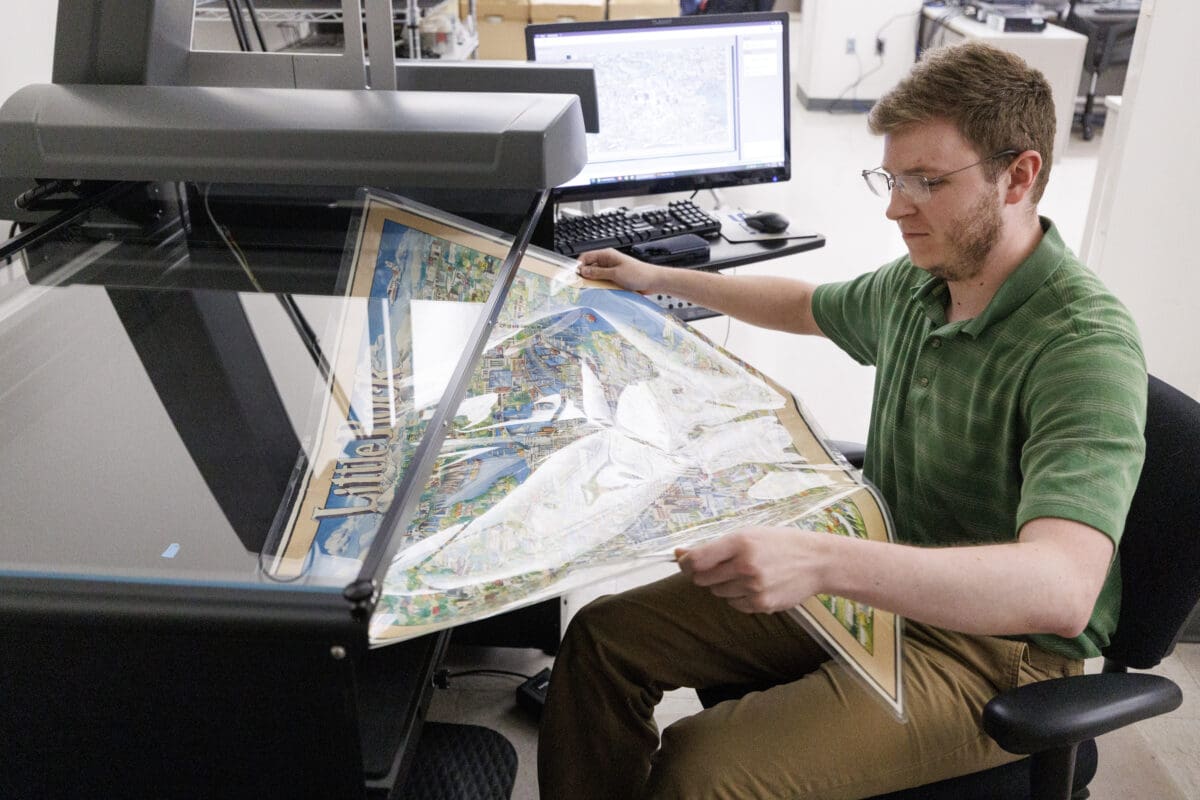
James Wethington, archivist and engagement coordinator at the CAHC, led the project, assisted by undergraduate student Cole Hadden and graduate assistant Noah Adebanjo. The work involved not only scanning and cataloging the maps but also developing a thematic organizational system and creating a comprehensive finding aid.
“Our only record of many of these maps used to be in an old card catalog,” Wethington said. “Now, the entire map collection is digitized and searchable. That’s a dream come true for an archivist.”
The searchable collection, available on the CAHC digital platform, includes categories such as Arkansas cities, U.S. regions, and world maps. Among the highlights are:
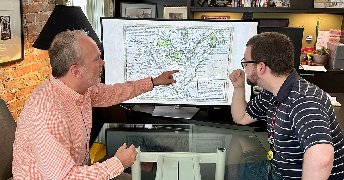
· A beautifully detailed 1712 map of New France by cartographer Herman Moll
· A 1907 map of Fort Smith, Oklahoma, a proposed sister city to Fort Smith that never came to pass
· A 1923 Arkansas railroad map by F.L. Blaisdell
· A 1960 Little Rock Housing Authority map for the Central Little Rock Urban Renewal Project
· A series of hundreds of Missouri Pacific Railroad maps spanning multiple states
“These are some of the coolest maps I’ve ever seen,” Wethington said. “They help us understand how our cities, state, and even the nation have changed over time. That’s the power of access.”
In addition to the primary map collection, the team also preserved and organized a separate collection of architectural drawings and Missouri Pacific Railroad maps. These maps required extra care due to their size and fragility, with many of the maps being over five feet long.
“One of the joys of this work is the surprise,” Porter said. “The center’s map collection came together through decades of individual donations and transfers. Many of the maps are one-of-a-kind, each telling its own story of Arkansas’s spatial and cultural evolution.”
Student involvement was central to the project. Hadden, a Donaghey Scholar who recently completed his undergraduate history degree, gained hands-on experience in archival processing, project planning, and digital preservation.
“For someone like Cole to work one-on-one with James for three years is invaluable,” Porter said. “He’s started graduate school in England this fall. The experience and mentoring that he received from James through the years make him competitive with people with graduate degrees already, and it’s specifically because of the opportunity and expertise he got at the CAHC.”
While the original grant objectives were met a year ahead of the project deadline, CAHC plans to continue its map preservation efforts. Future work will include processing the center’s Metroplan collection and other unprocessed materials.
“We far exceeded what we set out to do thanks to the Arkansas Community Foundation’s support,” Porter said. “But this is just the beginning. We will continue telling the spatial story of Arkansas.”
The newly digitized maps are available for public access through CAHC’s digital collections portal.