Dedication to Open Trail of Tears Park
The Trail of Tears park dedication has been moved to the atrium outside the Sequoyah Research Center and rescheduled to 1:15 due to rain.
 Two years ago, a collection of dilapidated old concrete block buildings and cracked asphalt adjacent to Coleman Creek marked a spot on the old Southwest Trail where thousands of native people walked the “long walk,” forced west by the federal government to designated Indian territories in what is now Oklahoma and points west.
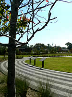
Today, the site is a serene 4.5 acre park planted with native trees, grasses, and other species that travelers along the trail might have seen and experienced.
At 1 p.m. Wednesday, Oct. 12, representatives of the Choctaw Nation and the Chickasaw Nation will join with central Arkansas officials and UALR administrators and partners to dedicate the new Trail of Tears Park on the banks of the creek on the Southwest Trail, which is now Asher Avenue.
The dedication ceremony will be followed by a reception and tour in the Sequoyah National Research Center in the adjacent University Plaza. For more information, contact 501-569-3390.
 The $650,000 donor-financed park project has restored the area to its natural state with native trees, rocks, and grasses. Just a few years ago, the area was the site of several unusable concrete buildings, an old bowling alley, an abandoned restaurant, and acres of asphalt.
The park project is the first in a community and campus planned Coleman Creek project, described in UALR’s Master Plan, “On the Move.” It calls for the creation of a 47-acre greenway reaching the full length of campus with lush vegetation, bicycle and walking trails, benches, and bridges.
Landscape engineers believe the Trail of Tears Park and subsequent Coleman Creek Greenway will be the biggest project of de-urbanization in the history of Arkansas.
 The new park is the southern entrance to campus. Three stanchions on the north end of a circular brick walkway in the new park hold tablets that tell the history of the Southwest Trail, the network of travel routes that connected the mid-Mississippi valley to the Red River valley.
Indigenous people used the trails as trade routes before Europeans came to the new world. The explorer Hernando de Soto likely traveled on the trail in 1541. The trail was an immigration route from 1810 to 1840 for settlers from the Midwest heading to Texas and the West.
For the Choctaws, it was “the long walk,” the Indian Removal Act that forced hundreds of thousands of men, women, and children from most North American tribes. Those who walked the old Southwest Trail likely stopped for water at the small creek that crossed the trail, now Asher Avenue.
The Indian Removal Act of 1830 forced 15,000 Choctaw, 7,000 Chickasaw, 21,000 Muskogee, 16,000 Cherokees, and 4,000 Seminoles onto the “Trail of Tears” to designated Indian territories to the west.
The trail was a military road in the 1860s carrying troops and supplies during the Civil War. Modern travelers drive the trail when they travel the area. U.S. 67 north and Interstate 30 parallels the ancient trail, as does Asher Avenue.